
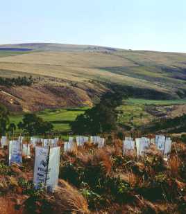
The Grow West area covers a diversity of landscapes, from fertile alluvial river flats, rolling pastures, slight slopes to steep gorges. Larger landholders generally crop the fertile alluvial flats and plains.
The drier slopes tend to be less arable. These areas are often less well managed, resulting in the invasion of rabbit, foxes and weeds. These pests may then invade more productive areas and native vegetation.
Vegetable growing and orchards are also present on the deep alluvial soils, accessing irrigation water from the Werribee and Lerderderg Rivers. The region hosts a large proportion of lifestyle landholders, who have purchased a few acres on which they run a few horses, cattle or sheep or are not actively managing their land. Generally only small pockets of remnant vegetation exist on private properties, with some larger areas of remnants on a few properties.
Most of the remaining indigenous vegetation is found on the substantial public land in the Brisbane Ranges National Park, Werribee Gorge State Park, White Elephant Reserve, Long Forest Flora and Fauna Reserve, Pyrete State Forest, Lerderderg State Park and Wombat State Forest. The Werribee River, Lerderderg River, Parwan Creek, Korkuperrimul Creek, Djerriwarrah Creek, Pykes Creek, Dale Creek, Myrniong Creek, Spring Creek, Yaloak Creek, and Whitehorse Creek all dissect the project area. There are three reservoirs present in the project area: Pykes Creek, Merrimu, and Melton.
Pykes Creek and Merrimu supply water to Myrniong, Bacchus Marsh and Melton for both domestic and agricultural purposes Melton Reservoir supplies water for irrigated agriculture and recreation only.